Branching off United States Highway 395 in California’s Eastern Sierra, State Route 158—famously known as the June Lake Loop—delivers 16 miles of pure alpine magic. Often referred to as the “Switzerland of California,” this horseshoe-shaped scenic drive loops around four glistening mountain lakes, cuts through dense groves of quaking aspens, and sits beneath the shadows of towering granite peaks like Carson Peak and Mount Ridge. Whether you are seeking peak autumn fall foliage, summer kayaking, or a tranquil detour on your Eastern Sierra road trip, a June Lake Loop scenic drive is an absolute must when exploring Mono County.
Overview of State Route 158
The June Lake Loop serves as a scenic bypass parallel to US-395, situated approximately 20 miles north of Mammoth Lakes and 12 miles south of Lee Vining. Because SR-158 forms a horseshoe, travelers can enter from either the South Junction or the North Junction. Driving the entire loop without stopping takes under 30 minutes, but taking time to explore the pull-offs, lakefront beaches, historic resort cabins, and trailheads makes for an unforgettable half-day or full-day excursion.
| Quick Fact | Details |
|---|---|
| Total Distance | 15.8 Miles (SR-158) |
| Location | Mono County, Eastern Sierra, CA |
| Key Water Bodies | June Lake, Gull Lake, Silver Lake, Grant Lake |
| Best Time to Visit | June through October (Fall foliage peaks late Sept – mid Oct) |
| Road Conditions | Paved two-lane road; winter closures depend on snow levels |
Mile-by-Mile Turn-by-Turn Driving Guide
1. South Junction & Entrance (Mile 0)
Entering SR-158 from the South Junction off US-395 immediately shifts the landscape from open sagebrush basin to towering alpine canyon walls. Within the first mile, you’ll feel the elevation gain as pine trees thicken along the roadside and views of Mount Morgan begin to reveal themselves.
2. June Lake Village & June Lake Beach (Miles 1.5 – 3.0)
Your first major milestone is June Lake itself, the deepest of the four lakes on the loop. Turning onto June Lake Beach Road brings you to a wide sandy shoreline that is ideal for swimming, paddleboarding, and launching kayaks. Continuing along SR-158 brings you into June Lake Village, a historic mountain community filled with charming cafes, local gear shops, and cozy cabins.
For official travel details, park regulations, and local business directories, visit the Mono County Official Government Website.
3. Gull Lake & Community Park (Mile 3.5)
Just past the main village lies Gull Lake, the smallest lake on the loop, but one of the most popular for trout anglers and families. A gentle 1.5-mile walking trail circles the perimeter of Gull Lake, making it an easy stretch to stretch your legs before continuing your drive.
4. Silver Lake & Rush Creek Basin (Miles 6.0 – 7.5)
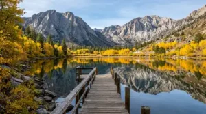
Continuing north, SR-158 winds past June Mountain Ski Area before opening up to the dramatic basin of Silver Lake. Framed by the sheer cliff faces of Carson Peak, Silver Lake offers some of the most photogenic vistas in all of Mono County. Here, you’ll find Silver Lake Resort—one of the oldest operating resorts in the Eastern Sierra, established in 1916. The nearby Rush Creek Trailhead offers a gateway into the Ansel Adams Wilderness for backcountry hikers.
5. Grant Lake & The Rush Creek Cut (Miles 9.0 – 14.0)
As you pass Silver Lake, the dense aspen forests gradually transition into the expansive shoreline of Grant Lake. Stretching over three miles long, Grant Lake is a reservoir popular for water skiing, wakeboarding, and shore fishing. The landscape opens up significantly here, offering sweeping views of the Mono Basin and the distant Mono Craters.
6. North Junction & Return to US-395 (Mile 15.8)
The final stretch of the loop gently descends through desert scrubland before reconnecting with US-395 just south of Mono Lake and Lee Vining. From here, drivers can either head north toward Bodie Ghost Town or south back toward Mammoth Lakes.
Seasonal Guide: When to Drive the June Lake Loop
Autumn (Late September to Mid-October)
Fall is arguably the most famous season for a June Lake Loop scenic drive. The region’s quaking aspens transform into vibrant corridors of gold, amber, and crimson. Spots around Silver Lake and Gull Lake host some of the top leaf-peeping viewpoints in California.
Summer (June to August)
Summer offers ideal weather for outdoor recreation. Marinas along June, Gull, and Silver Lakes rent pontoon boats, motorboats, and kayaks. Wildflowers carpet the canyon floors, and high-altitude hiking trails are generally clear of snow.
Winter & Spring (November to May)
During winter, June Mountain opens for skiing and snowboarding, offering a family-friendly vibe and breathtaking lake views from the slopes. Keep in mind that heavy snowfall can cause seasonal closures on the northern section of SR-158, though access to June Lake Village remains maintained via the South Junction.
Essential Driving & Travel Tips
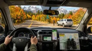
- Fuel Up Early: Fill your vehicle in Mammoth Lakes or Lee Vining before taking the loop, as gas options in the village can be limited.
- Observe Turnouts: SR-158 is a two-lane scenic road. Use designated turnouts if slower traffic accumulates behind you, especially when taking in the views.
- Check Road Conditions: Winter and early spring travel may require snow chains or 4WD/AWD capabilities. Check updated road statuses before heading out via the California Department of Transportation (Caltrans).
- Practice Leave No Trace: Pack out all trash, respect wildlife, and stay on established trails to preserve Mono County’s delicate mountain ecosystem.
Plan Your Eastern Sierra Escape
The June Lake Loop encapsulates the best of Mono County—glacial lakes, rugged peaks, rich history, and seasonal beauty packed into a brief 16-mile drive. Whether you’re making a quick scenic pitstop or spending a week exploring every mountain trail, SR-158 remains one of California’s most remarkable high-country byways.